The country, from above
The map
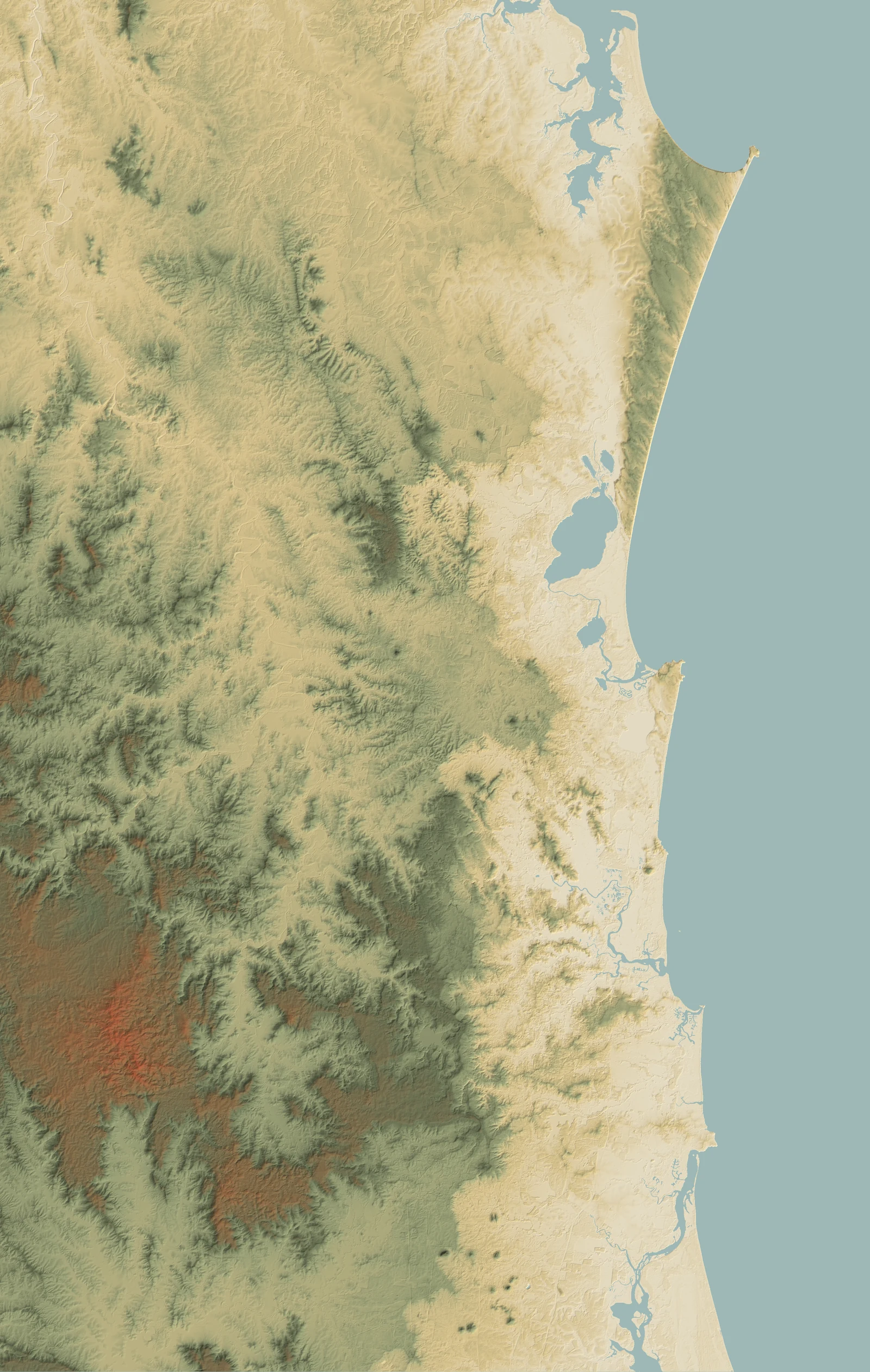
The whole story in one picture: the sea on the right, the sand and swamp of the coastal plain in cream, and the old ranges rising green-to-red in the west.
This is real terrain — a shaded-relief basemap built from the European Space Agency's 30-metre elevation model, tinted in the book's own palette. You are looking straight down the great gradient the whole app teaches: reef and estuary at the coast, the Cooloola sand mass and its dune lakes in the north, and the Conondale and Blackall ranges climbing to nearly 900 metres inland. Each marker is a place you can visit and read for yourself — tap one for its guide.
📍 Out on the coast? Read here — the country under your feet →
- Coastal tidal flats & beaches
- Coastal sand (dunes)
- Old sand & loam plains
- Alluvium (river & creek flats)
- Basalt
- Sedimentary rock
- Metamorphic ranges
- Granite & igneous rock
Remnant regional ecosystems only; cleared land, water and bare sand are not shaded.
 1 Carlo Sandblow 2 Wolf Rock (Double Island Point) 3 Cooloola (Great Sandy National Park) 4 The Noosa Everglades (Upper Noosa River) 5 Noosa headland (coastal rocky reefs) 6 Mount Tinbeerwah 7 Mount Ninderry 8 Mount Coolum 9 Mudjimba Island (Old Woman Island) 10 The Maroochy River flats 11 The Conondale Range 12 Kondalilla Falls 13 Point Cartwright & the Mooloolaba rocky reef 14 Mary Cairncross Reserve 15 The Glass House Mountains 16 Bribie Island & the Pumicestone Passage
 - 1 Carlo Sandblow Sand coast — the youngest, mobile front end of the dune chronosequence
- 2 Wolf Rock (Double Island Point) The marine end of the gradient — offshore pinnacle reef in the two-oceans overlap
- 3 Cooloola (Great Sandy National Park) Sand coast — wallum dune through paperbark swamp to estuary
- 4 The Noosa Everglades (Upper Noosa River) Wet lowland — freshwater blackwater above the brackish, tidal Lake Cootharaba
- 5 Noosa headland (coastal rocky reefs) The marine edge of the gradient — headland and rocky reef where the range meets the sea
- 6 Mount Tinbeerwah A hinterland volcanic-plug lookout that reads the whole gradient — sand country and lakes to the sea on one side, ranges climbing inland on the other
- 7 Mount Ninderry Isolated hinterland peak standing above the coastal lowland
- 8 Mount Coolum Isolated volcanic dome rising off the coastal sand plain, near the sea
- 9 Mudjimba Island (Old Woman Island) Offshore rock island and fringing reef — the two-oceans overlap made into a predator-free refuge
- 10 The Maroochy River flats Tidal floodplain — the bottom of the gradient, where the Maroochy meets the sea
- 11 The Conondale Range High-rainfall inland ranges — the wettest, tallest pole of the forest gradient
- 12 Kondalilla Falls Range crest and gorge — the wet, fertile top of the reef-to-range climb, cut by a waterfall
- 13 Point Cartwright & the Mooloolaba rocky reef The seaward edge of the gradient — a headland rocky reef in the two-oceans overlap, where the land goes under the sea
- 14 Mary Cairncross Reserve Range crest — high-rainfall top of the reef-to-range climb
- 15 The Glass House Mountains Volcanic plug — hard-rock peaks off the lowland; dry eucalypt forest and montane heath on rock, rainforest in the gullies
- 16 Bribie Island & the Pumicestone Passage The bottom of the gradient — a sheltered estuarine tidal passage between a sand island and the mainland, backed by wallum sand and the range beyond